CHAKRATA

| — city — | |
Chakrata
|
|
| Coordinates: 30.69°N 77.86°ECoordinates: 30.69°N 77.86°E | |
| Country | |
| State | Uttarakhand |
| District | Dehradun |
| Elevation | 2,118 m (6,949 ft) |
| Population (2001) | |
| • Total | 3,497 |
| Languages | |
| • Official | Hindi |
| Time zone | IST (UTC+5:30) |

 |
| market sight |
It is situated between the Tons and Yamuna rivers, at an elevation of 7000–7250 feet, 98 km from state capital, Dehradun, it was originally a cantonment of British Indian Army. Due west lies Himachal Pradesh, and due east are Mussoorie (73 km), Garhwal.
History
The area is known as Jaunsar-Bawar,belonging to the Jaunsari tribe, which still has a marked presence in the surrounding villages.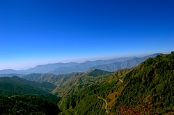
 In 1901, Chakrata Tahsil was part of the Dehradun district, of United Provinces,
with a collective population of 51,101, which consisted of the towns of
Chakrata (population 1250) and Kalsi, with a population of 760, which is most known for the rock edict of the Mauryan king Ashoka 2nd century BC, first discovered by John Forest, in 1860.
In 1901, Chakrata Tahsil was part of the Dehradun district, of United Provinces,
with a collective population of 51,101, which consisted of the towns of
Chakrata (population 1250) and Kalsi, with a population of 760, which is most known for the rock edict of the Mauryan king Ashoka 2nd century BC, first discovered by John Forest, in 1860.The cantonment

Local attractions

The area has an abundance of conifers, rhododendrons and oaks. The red rhododendrons are the most abundantly found in this region. A key attraction near Chakrata is the waterfall named Tiger Fall. A secluded -nearby, leafy hamlet of Deoban offers a panoramic view of the Himalayas stretching from Kinnaur to Garhwal and Kumaon.

The alpine meadows of Mundali (2776 mts.), offers skiing opportunities, November to April.
There are approx. 2-3 basic private hotels in Chakrata, and some dhabas. Petrol and diesel are hard to come by (for civilians), but can be obtained in small quantities from local traders. The most famous hotel of chakrata is Hotel Himalayan Paradise and Hotel Snow View(estd 1936).

Demographics
As of 2001 India census,Chakrata had a population of 3497. Males constitute 62% of the population and females 38%. Chakrata has an average literacy rate of 75%, higher than the national average of 59.5%; w ith male literacy of 81% and female literacy of 65%. 12% of the population is under 6 years of age.References
- ^ a b Chakrata Tahsil & Town The Imperial Gazetteer of India, 1909, v. 10, p. 125.
- ^ Chakrata Official website of Dehradun city.
- ^ Chakrata
 This article incorporates text from a publication now in the public domain: Chisholm, Hugh, ed. (1911). Encyclopædia Britannica (11th ed.). Cambridge University Press..
 - ^ Kalsi Official website of Dehradun city.
- ^ Lakhamandal temple Official website of Dehradun city.
- ^ a b Excursions from Chakrata Garhwal Tourism.
- ^ "Census of India 2001: Data from the 2001 Census, including cities, villages and towns (Provisional)". Census Commission of India. Archived from the original on 2004-06-16. Retrieved 2008-11-01.